Cape York Peninsula
Largest wilderness in northern Australia with global environmental significance.

via Wikipedia: Cape York Peninsula · see source
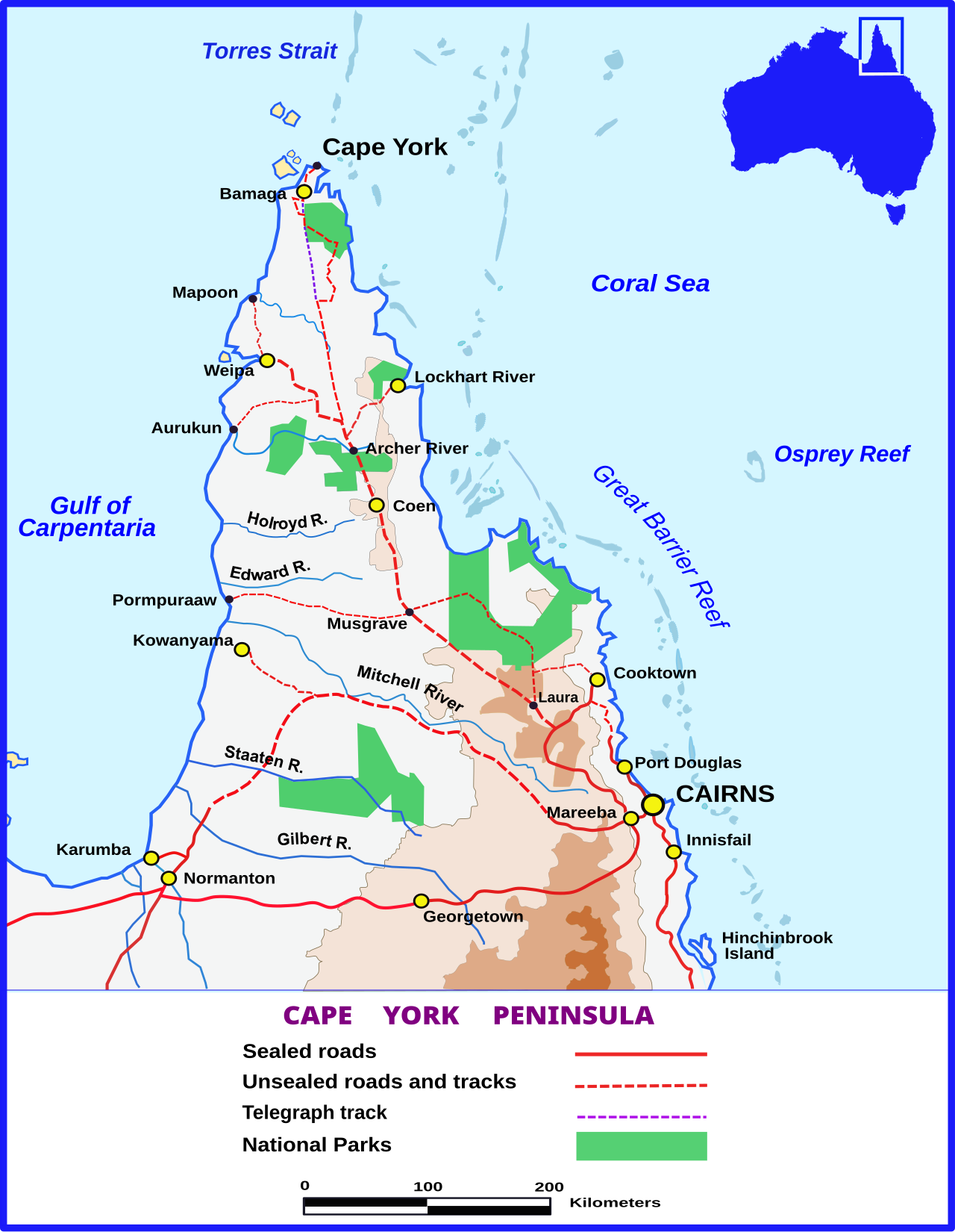
The Cape York Peninsula is located in Far North Queensland, Australia. It is the largest wilderness in northern Australia. The land is mostly flat and about half of the area is used for grazing cattle. The relatively undisturbed eucalyptus-wooded savannahs, tropical rainforests and other types of habitat are now recognised and preserved for their global environmental significance. Although much of the peninsula remains pristine, with a diverse repertoire of endemic flora and fauna, some of its wildlife may be threatened by industry and overgrazing as well as introduced species and weeds. The northernmost point of the peninsula is Cape York. The land has been occupied by a number of Aboriginal Australian peoples for tens of thousands of years. In 1606, Dutch sailor Willem Janszoon on board the Duyfken was the first European to land in Australia, reaching the Cape York Peninsula.
- location
- Far North Queensland, Australia
- area
- Approximately 430 km wide at its widest point, 660 km long from southern border
- highest_point
- 800 m elevation in the McIlwraith Range
- climate
- Tropical savanna with heavy monsoon season (November to April) and dry season (M
- notable_feature
- Northernmost point of the Australian mainland is Cape York
Verified Timeline
Lore & Background
The Cape York Peninsula has been occupied by a number of Aboriginal Australian peoples for tens of thousands of years. The first recorded European landing in Australia occurred in February 1606, when Dutch navigator Willem Janszoon landed near the site of what is now Weipa, on the western shore of Cape York Peninsula. This also marked the first reported contact between European and Aboriginal Australian people. European exploration continued in the 19th century. Edmund Kennedy was the first European explorer to attempt an overland expedition of Cape York Peninsula. The expedition set out from Rockingham Bay near the present town of Cardwell in May 1848, and it turned out to be one of the great disasters of Australian exploration. Of the thirteen men who set out, only three survived. Kennedy died of spear wounds almost within sight of his destination in December 1848. The only survivor to complete the journey was Jackey Jackey, an Aboriginal man from New South Wales. The tip of the peninsula (Cape York) was finally reached by Europeans in 1864 when the brothers Francis Lascelles (Frank) and Alexander William Jardine, along with eight companions, drove a mob of cattle from Rockhampton to the new settlement of Somerset, finally arriving in March 1865.
Reader's Guide
The Cape York Peninsula is significant as the largest wilderness in northern Australia and for its global environmental importance. Its relatively undisturbed habitats include eucalyptus-wooded savannahs, tropical rainforests, and other ecosystems that support a diverse repertoire of endemic flora and fauna. However, some wildlife may be threatened by industry, overgrazing, introduced species, and weeds. The peninsula's rivers are noted for their exceptional hydrological integrity. With little disturbance on both water flows and vegetation cover throughout entire catchments, Cape York Peninsula has been identified as one of the few places where tropical water cycles remain essentially intact. Cape York Peninsula contributes as much as a quarter of Australia's surface runoff. Indeed, with only about 2.7 percent of Australia's land area, it produces more run-off than all of Australia south of the Tropic of Capricorn. The Queensland Government is currently poised to protect 13 of Cape York Peninsula's wild rivers under the Wild Rivers Act 2005. The peninsula's soils are remarkably infertile even compared to other areas of Australia, being almost entirely laterised and in most cases so old and weathered that very little development is apparent today. It is because of this extraordinary soil poverty that the region is so thinly settled: the soils are so unworkable and unresponsive to fertilisers that attempts to grow commercial crops have usually failed.
Did You Know?
- The first recorded European landing in Australia was by Dutch sailor Willem Janszoon on the Cape York Peninsula in February 1606.
- Cape York Peninsula contributes as much as a quarter of Australia's surface runoff, despite covering only about 2.7 percent of the country's land area.
- The peninsula's soils are so infertile they are classified as orthents in USDA soil taxonomy, and attempts to grow commercial crops have usually failed.
- The only survivor to complete Edmund Kennedy's disastrous 1848 overland expedition was Jackey Jackey, an Aboriginal man from New South Wales.
- Cape York was named by Lieutenant James Cook on 21 August 1770 in honour of Prince Edward, Duke of York and Albany.
European Exploration & First Contact
In February 1606, Dutch navigator Willem Janszoon landed near the site of what is now Weipa, on the western shore of Cape York Peninsula. This was the first recorded landing of a European in Australia, and it also marked the first reported contact between European and Aboriginal Australian people. For over two centuries the peninsula remained largely unexplored by outsiders. That changed in 1848 when Edmund Kennedy, who had been second-in-command to Thomas Livingstone Mitchell in 1846 when the Barcoo River was encountered, led a thirteen-man overland expedition from Rockingham Bay near the present town of Cardwell. The aim was to establish a route to the tip of the peninsula, where Sydney businessmen were attempting development of a port for trade with the East Indies. The expedition turned out to be one of the great disasters of Australian exploration. Of the thirteen men who set out, only three survived. The others died of fever or starvation, or were speared by hostile Aboriginal people. Kennedy died of spear wounds almost within sight of his destination in December 1848. The only survivor to complete the journey was Jackey Jackey, an Aboriginal man from New South Wales. He led a rescue party to the other two who had been unable to continue. The tip of the peninsula (Cape York) was finally reached by Europeans in 1864 when the brothers Francis Lascelles (Frank) and Alexander William Jardine, along with eight companions, drove a mob of cattle from Rockhampton to the new settlement of Somerset (on Cape York) where the Jardines' father was commander. En route they lost most of their horses, many of their stores and fought pitched battles with Aboriginal people, finally arriving in March 1865.
Ancient Geology & Landforms
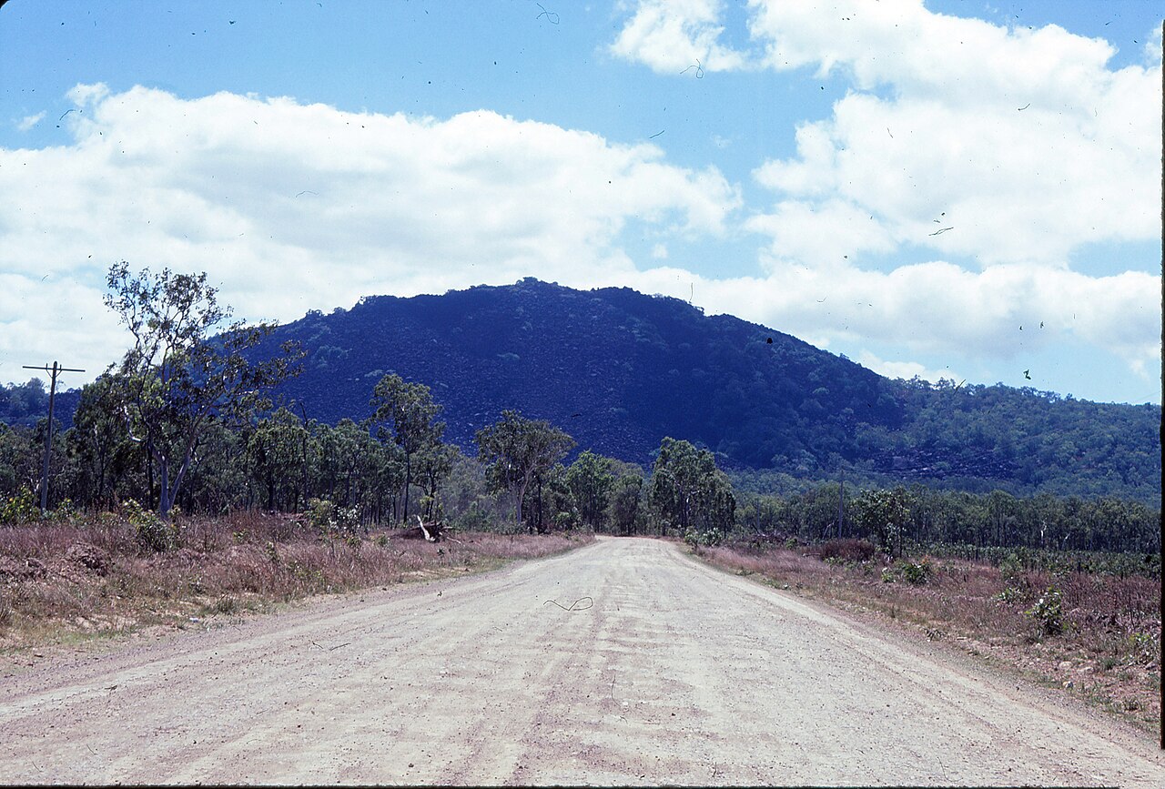
The backbone of Cape York Peninsula is the peninsula ridge, part of Australia's Great Dividing Range. This mountain range is made up of ancient (1.5 billion-year-old) Precambrian and Palaeozoic rocks. To the east and west of the peninsula ridge lie the Carpentaria and Laura Basins, respectively, themselves made up of ancient Mesozoic sediments. The peninsula is formed from the northern part of the Great Dividing Range, folded during the Carboniferous period some 300 million years ago, when Australia collided with what is now parts of South America and New Zealand. The range has experienced significant erosion since. The tropical landscapes are among the most stable in the world. Long undisturbed by tectonic activity, the peninsula is an extremely eroded, almost level low plain dominated by meandering rivers and vast floodplains, with some very low hills rising to 800 m (2,600 ft) elevation in the McIlwraith Range on the eastern side around Coen. There are several outstanding landforms on the peninsula: the large expanses of undisturbed dunefields at the eastern coast around Shelburne Bay and Cape Bedford-Cape Flattery, the huge piles of black granite boulders at Kalkajaka National Park and Cape Melville, and the limestone karsts around Palmerston in the peninsula's far south. At the peninsula's widest point, it is 430 km (270 mi) from the Bloomfield River in the southeast, across to the west coast just south of the aboriginal community of Kowanyama. It is some 660 km (410 mi) from the southern border of Cook Shire, to the tip of Cape York.
Soil Poverty & Tropical Climate
One of the peninsula's most defining characteristics is its extraordinary soil poverty. The soils are remarkably infertile even compared to other areas of Australia, being almost entirely laterised and in most cases so old and weathered that very little development is apparent today (classified in USDA soil taxonomy as orthents). It is because of this extraordinary soil poverty that the region is so thinly settled: the soils are so unworkable and unresponsive to fertilisers that attempts to grow commercial crops have usually failed. The climate on Cape York Peninsula is tropical savanna in the south, with a heavy monsoon season from November to April, during which time the forest becomes almost uninhabitable, and a dry season from May to October. The temperature is warm to hot, with a cooler climate in higher areas. The mean annual temperatures range from 18 °C (64 °F) at higher elevations to 27 °C (81 °F) on the lowlands in the drier southwest. Temperatures over 40 °C (104 °F) and below 5 °C (41 °F) are rare. Annual rainfall is high, ranging from over 2,000 mm (79 in) in the Iron Range and north of Weipa to about 700 mm (28 in) at the southern border. Almost all this rain falls between November and April, and only on the eastern slopes of the Iron Range is the median rainfall between June and September above 5 mm (0.2 in).
Aboriginal Heritage & Environmental Significance
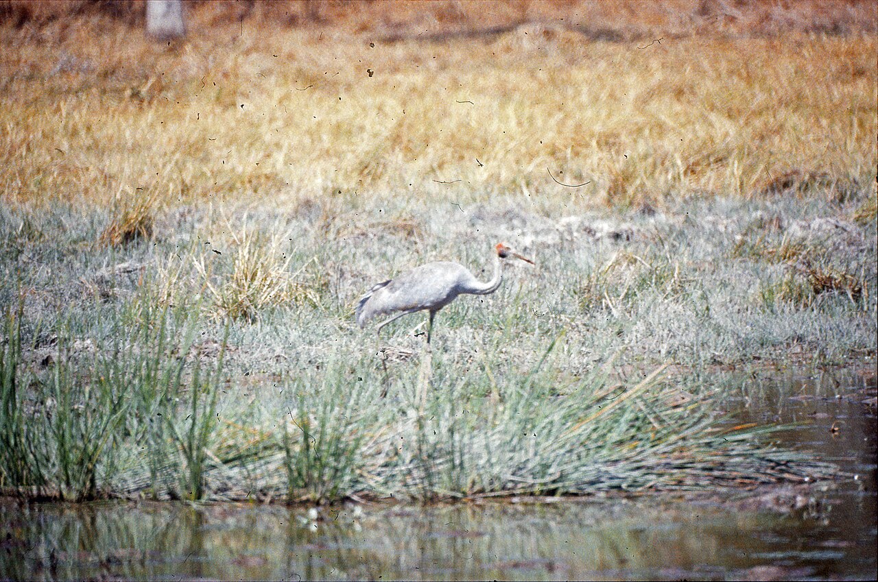
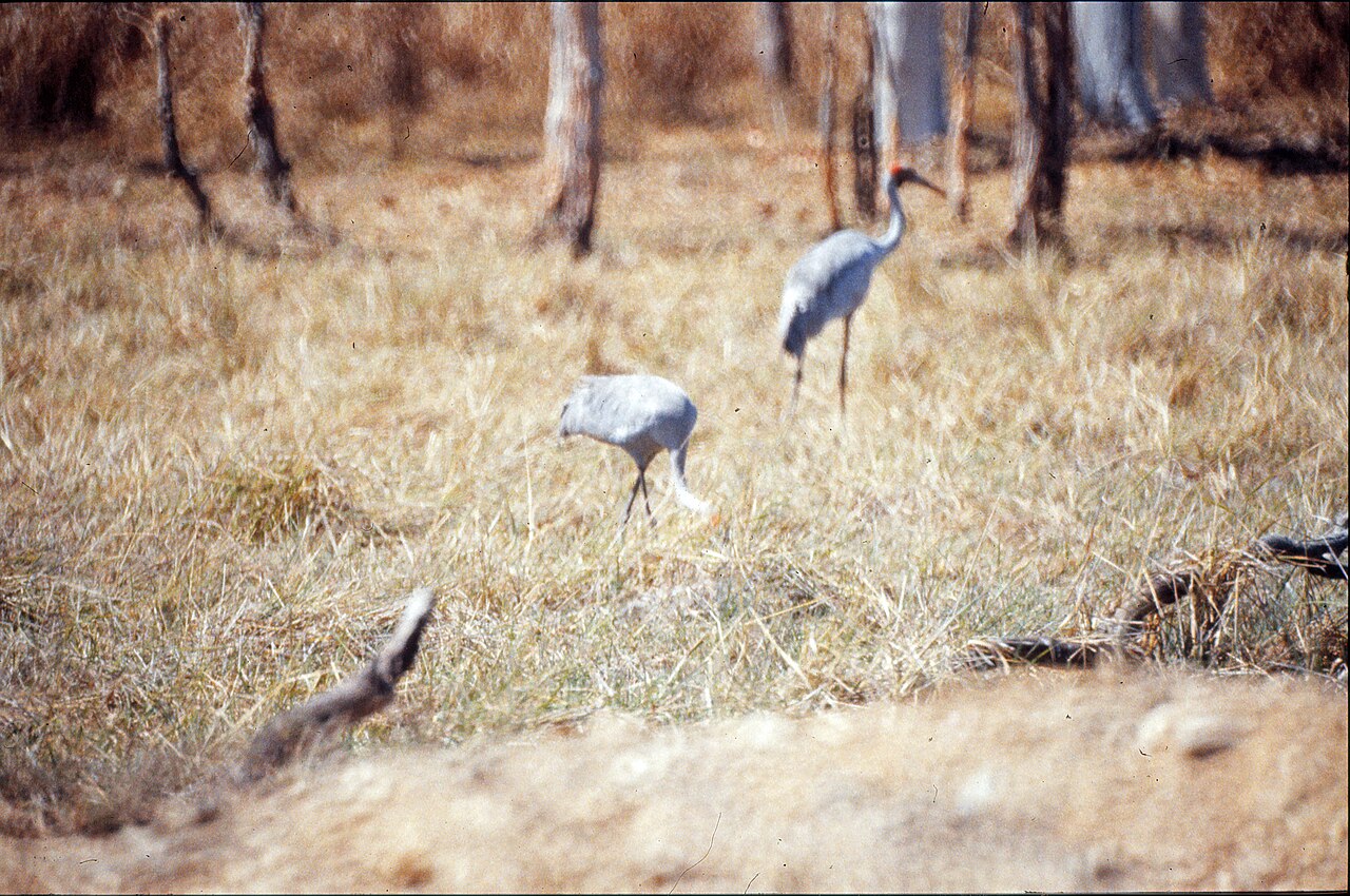
The land has been occupied by a number of Aboriginal Australian peoples for tens of thousands of years. The first known contact between European and Aboriginal people occurred on the west coast of the peninsula in 1606, but it was not settled by Europeans until the 19th century when fishing communities, then stations and later mining towns were established. European settlement led to the displacement of Aboriginal communities and the arrival of Torres Strait Islanders on the mainland. Today the peninsula stands as the largest wilderness in northern Australia. The relatively undisturbed eucalyptus-wooded savannahs, tropical rainforests and other types of habitat are now recognised and preserved for their global environmental significance. Although much of the peninsula remains pristine, with a diverse repertoire of endemic flora and fauna, some of its wildlife may be threatened by industry and overgrazing as well as introduced species and weeds. The northernmost point of the peninsula is Cape York. It was named by Lieutenant James Cook on 21 August 1770 in honour of Prince Edward, Duke of York and Albany, a brother of King George III of the United Kingdom, who had died three years earlier. The peninsula is bordered by water on three sides (north, east and west). The west coast borders the Gulf of Carpentaria and the east coast borders the Coral Sea.
Gallery
Frequently Asked Questions
Who is Cape York Peninsula?
Cape York Peninsula is a massive landform in Far North Queensland, Australia, stretching roughly 660 km from its southern border down to the mainland's northernmost tip. It is the largest continuous wilderness region in northern Australia.
What are Cape York Peninsula's powers/role?
It holds global environmental significance by preserving relatively undisturbed eucalyptus-wooded savannahs, tropical rainforests, and a wide range of other habitats. Its highest ground sits in the McIlwraith Range at around 800 metres elevation.
How does Cape York Peninsula's story end?
There is no final chapter, because the peninsula remains a living, occupied landscape to this day. Its recorded narrative includes the 1606 landing by Dutch sailor Willem Janszoon, the first documented European contact with the Australian continent.
Why is Cape York Peninsula important?
Aboriginal Australian peoples have called this region home for tens of thousands of years, making it one of the longest-continuously inhabited places on Earth. Its ecosystems are recognised worldwide as a benchmark of undisturbed tropical and savanna biodiversity.
What is Cape York Peninsula's size and shape?
At its broadest the peninsula measures approximately 430 km across, tapering northward into a long, narrow finger of land. Its climate swings between a heavy monsoon season from November to April and a drier stretch from May to October.
More in Peninsulas And Cape Landforms 1-24
Spotted an error? Know more?
This is a living reference — every entry is fact-audited, and reader corrections feed straight into our audit queue. Suggest an edit · See this site's audit record